As I write this I am comfortably ensconced in Brunswick Landing Marina, Brunswick Georgia. It's a beautiful, well run marina and my new 424 buddy, Lee Yonkers is berthed just across the finger from me! But getting here was not so easy, my friends.
It's a tale of heavy winds, driving rain, freezing temperatures and long, lonely watches.
When I left Beaufort, SC it was drizzling, overcast and generally depressing weather. But I had the current with me! The day had been forecast to have heavy rain, gale or near gale force winds and to continue for two days with awful weather to be outside in. You lot in the mid-Atlantic states and New England have some idea. It was the day Washington, DC got two feet of snow. Incidentally, I would have paid to see that. But I digress.
Anyway, it was just wet for most of the trip until I crossed the Savannah River. Then all hell broke loose! The wind was steady 28-30 knots with gusts to 35 or so. Of course, right on the nose... As I passed Thunderbolt the seas (and given this is a narrow stream) were three feet with the tops of the waves being blown off. The only good thing was that for some reason the wind was 10 to 15 degrees warmer than the rest of the day! Man, I forgot what 30 mile per hour rain feels like - it hurts!
A half hour after it started it was over and I pulled into the Isle of Hope marina for the night. Naturally, as I tied up to the dock, the wind died, the sun came out, and the temperature remained fairly warm. That night it was cold. I'm glad I had a heater aboard! The marina is very nice - new concrete floating docks and all.
The next day dawned cold (ice on the docks) but clear and I was off at 0710. I was pushing to get to Brunswick GA so I wanted as much daylight as possible. So after a day of mostly going into the wind against the current I arrived at the Darien River where there's a small but fairly well protected anchorage.
There was another boat already anchored when I arrived. There was also a fairly strong current. I managed to alternately amuse and worry him as he watched me drop the anchor, drift too close, pull the anchor up, move a little farther away and try again. This happened twice before I finally figured out how to manage the current and wind to drop the anchor just where I wanted it.
Sunset was spectacular! The night was cold but bearable and like being on land it was so calm. I was only about 20 miles from Brunswick so I lounged about until 0800 and puttered on off to Brunswick Landing Marina. The wind was much lighter than the day before but it wasn't until noon or so when I got to the marina when it started to warm up.
With much help I tied up across the finger from a 424 organization member, Lee.
So here I am at Brunswick Landing Marina in Georgia. I'll be here for a couple of weeks during Christmas week and New Years week before I travel on.
Merry Christmas & Happy New Year!
See you on the water!
Monday, December 21, 2009
Thursday, December 17, 2009
Mosquito Creek, A Rescue, and Beaufort, SC
Last night was cold. I mean, really cold. Or I'm getting old. But I think I'll stick with cold. I left Charleston around 0815 near slack high tide so I could get through the 0900 opening at the Wahpoo Creek Bridge. Needless to say, I just made it running full bore! But after that, it was all good. Motorsailing down the ICW can be relaxing and fun. It saves fuel and you can convince yourself that if it weren't for the narrowness you could sail the whole thing top to bottom. (Hint: you can't.)
 So as it was approaching 1500 (3:00pm) and the sun sets here at like 4:30, I was looking for a place to stop. It turns out that just near a crucial turn in the ICW is a place called Mosquito Creek. I am glad for the cold - I'd hate to be there in the summer since I'm pretty sure the name is very descriptive of the wild life. Anyway, at a shrimper's dock, B & B Seafood, I tied up for the evening for a whopping $25. True, there's nothing there except a seafood market. No electricity, only fuel. But compared to Charleston Maritime Center, it was quiet with no wakes to heave you out of your bunk at 0h-dark-thirty.
Don't get me wrong, I loved the Charleston Maritime Center except for that. If I were prone to seasickness, I'd've been.
Anyway, it was a lovely quiet creek and I slept extraordinarily well, given I was in my fleece pants, vest, t-shirt and BVDs and socks. After a dinner of carne asada and broccoli, I read for a couple of hours and was fast asleep under the covers.
This morning I was up and underway at 0715 headed, I thought, for Bull Creek SC for a night at anchor. As the morning wore on, I found that I'd be in Beaufort (pronounced 'bee-yew-frt', as opposed to North Carolina's 'bo-frt') waiting for the Ladies Island Bridge for the 10:30 opening. I had hoped to make it at 0900, but hey, sometimes plans just go awry.
As I was spinning Pelican to bear away from the bridge I saw a lump in the water - then the lump started waiving. Then the lump started shouting, "Help! Help!" This was at 1025, so I resigned myself to missing the 1030 opening and headed over to get the poor bastard out of the water. I threw my emergency ladder overboard, stopped Pelican about three feet from him and asked him to bring the painter with him onboard - he handed me the painter and climbed up the ladder soaked to the skin.
I put his capsized boat under tow, called the bridge to say I'd be traversing slowly because of the capsized boat under tow and the bridge operator was very understanding. Anyway, I made the opening and brought the poor blighter to the dock at Beaufort Downtown Marina.
Well, he'd been nicked by the prop in the capsize, but I saw he wasn't bleeding and that he'd make a medical center once he called his brother and got a ride. I pulled his boat out of the water onto the dock and let it drain. His brother showed up, took the motor and the soaked guy, and with hearty handshakes all around, was off.
Since I'd already tied up to the dock and all, and since it was going to be cold that night, and because I saved a man's life, I decided to stay as a reward. So here I am at Beaufort, SC where but for fate I would have blown by at a blistering speed of seven knots.
 My friend, Cory, reminded me that I'd been there before on their boat delivering it north from Ft. Lauderdale a year ago or so. Anyway, I thought I'd have a bit of a look around and took a walk - also, the marina provided a coupon in their little package for a free chocolate sand dollar at the local confectionery so that was something of an encouragement to leave the boat.
Off I went, having a look about - taking a few pictures, and of course getting my free chocolate (which cost $10.00 because I had to purchase some dark chocolate cashew bark, don't you know).
 As I was walking back, I thought I'd go to the top of the bridge and get a picture of the whole town of Beaufort when I espied another Pearson 424 waiting for the opening - the boat's name is Sea Zen and the only person I met was Beth, although I asked them all over for wine and cheese if they could make it. Unfortunately, they were pressed for time and weren't able to come, but Dave and Nancy from Liberty, a Morgan 40 something, did and we had a great evening! Also, I learned a lot from them about the Dry Tortugas. That may come in handy later.
 When the evening was done, I toodled off to bed with heaters blazing and slept amazingly well.
Tomorrow, I have to make 50 miles (a little less in nautical miles). So maybe I'll see you on the water!
Tuesday, December 15, 2009
Navigation Software
I've been in Charleston long enough. After you soak up so much history, eat so many shrimp and grits meals, walk so many miles looking at truly magnificent homes, you're bound to take a day or three to explore some software. Ok, maybe not all of you.
So here's the thing: free navigation software. Now, NOAA has been supplying charts in digital formats for a few years now. Like books, there's nothing like a paper chart to keep track of where you are in the world (I can't translate lat and long numbers to a physical position in my head without a chart. I suspect most people can't).
Of course, chartplotters exist on many boats. I have two - a Raymarine C80 and a Raytheon Pathfinder as a backup. I'm very happy with both systems, but what about someone who doesn't have unlimited funds to acquire this stuff? What do they do? Well, here's the answer and it's way less expensive than you can imagine.
Maptech supplies charting software with its chart kits. It's copy protected, difficult to use, and requires, at this time, finding and installing an update to use Garmin hand-held GPSs. Because it's a 'lite' version of their charting software, there's a bunch it doesn't do. Moreover, it can only be used on one computer - if you need to move it to a different one, you have to convince Maptech that it's a legal move. Those 'features' are the kind that killed Lotus 123 and dBase as premier software packages in the '80s. Apparently big companies don't learn all that well.
That said, there are two programs that I know of that are free and use the free downloadable charts from NOAA.
Before I go there, though, there are two types of charts NOAA supplies called Raster Navigational Charts (RNC) and Electronic Navigational Charts (ENC). RNCs are a digital picture of the real paper charts. If you could print them out on a large size printer you would have essentially what you purchase in a store as paper charts - in fact, a company (Bellingham Chart Printers) exists that prints these files in grey scale for a fraction of the price of new colored charts. I know of world cruisers that have used them quite happily.
ENCs are data rich vector charts - they contain, essentially, a database of objects with attributes. If you query a mark, you'll receive the information about it such as name, color, purpose, height and other things. The charts themselves are visualized somewhat strangely to people used to using paper charts because they're line drawn. There's no shading. It's like looking at an architectural drawing, except with buoys.
Most chart plotters actually use both chart sets - the visualization is with the raster chart so it looks familiar, but when you click on something for information, it querys the underlying vector chart based on your cursor position and you get the presentation of the information.
Don't worry if this is getting too technical - if you're familiar with the transparencies of the human body in an encyclopedia (most have them) then you can picture how this works. If not, just take my word for it.
Now for the programs. The two I'll discuss are SeaClear II and OpenCPN. Although both are capable chart plotters and navigation aids, OpenCPN offers the ability to control the autopilot and set and save routes to follow. Both integrate easily with GPS units, with SeaClear II able to connect to Garmin units using the USB without modification. The OpenCPN uses NMEA 0183 exclusively.
Sea Clear II uses the RNCs and is very easy to use - it is not designed to be a full fledged navigation system, in my opinion. But it is very easy to use and very useful as a chart plotter. It allows you to make routes and save waypoints. I've used it for couple of years and it's great for deciding overall trip strategy. I like it alot.
I've recently been turned on to OpenCPN. I'm a big fan of open source software and I use Open Office instead of paying Microsoft huge sums of cash for a questionably useful product. But I digress. OpenCPN was written specifically to do all the things a chart plotter does - run autopilots, set and follow routes, provide information about navigational items and much more. As you move from place to place the program automatically loads the chart for that area at the closest scale it can find for where you currently on. Sometimes, that takes a few seconds, but I suspect that has more to do with my computer than anything else.
OpenCPN uses both RNCs and ENCs as I've explained above. There's a huge implication to this fact - first, all the charts that NOAA provides are free to download, and second, if you have a PC with a decent monitor and three USB or serial ports and a GPS unit you can have a full fledged navigation system/chart plotter. It will run any NMEA 0183 autopilot (like, for instance, Raymarine). It will use any NMEA GPS antenna (like, for instance Raymarine or Garmin). And it will run on Windows and Linux (and maybe Mac but I won't vouch for that). It accepts AIS input and displays it. It is very powerful.
So, if you wanted a system you could purchase a decent laptop for $500 or so, load it with Ubuntu (free linux), install the OpenCPN, connect your autopilot, your GPS antenna ($250), your AIS receiver (optional, but fun $500) and you'd have the equivalent of a $3000-$6000 system. Moreover, with a little ingenuity, you could add a display at your helm with a touch screen. To be perfectly honest, I'm tempted to try this myself...
Anyway, there you have it - free navigation software. If you've got the time and a PC, I'd sure enough have a look at both. The charts are free from NOAA - RNCs and ENCs. I find downloading them by Coast Guard Zone the easiest. Unzip to a directory you'll remember and point the program at it - then go to town (sea)!
That's it for now. I'm leaving Charleston to spend Christmas with friends in Brunswick GA.
See you on the water!
Saturday, November 21, 2009
More Charleston and the Engine Gets Quieter

The Ravenel Bridge is a new replacement bridge in Charleston that I-17 runs over. It's one of those new concrete suspension bridges and it replaces a steel trestle bridge. Like most of Charleston, it's pedestrian and bike friendly with a path for both on the south side of the bridge. The view of the harbor is spectacular! Since I didn't really feel like working yesterday, I unfolded my bike and went for a ride.
From t
 he Charleston Maritime Center to the park on the east side of the Ravenel Bridge and back is about 9 miles. The park on the east side consists of a 1/4 mile long pier with porch-swing type chairs, little shelters, and not a few fisherpeople. It's very pretty.
The ride up the west approach to the bridge is easy - not so much the eastern approach. I ended up walking most of that. Big surprise, huh? Anyway, I got to take the panorama above and you may enjoy examining it more closely.
When I left from Whiteside Creek a week ago, the windlass ceased to function while the anchor was still down. That really pissed me off, I can tell you. So Thursday the 19th, I decided to see what was wrong and fix it. Through troubleshooting, I found that my first thought was wrong - I thought it was a problem with the foot switches and corroded wiring or connectors. Alas, that wasn't it. That is easy to fix.
No, by calling a local motor repair shop, I figured out that the problem is that the brushes and commutator for the motor was scored and wouldn't let the motor start - when I removed it from the windlass, if I gave the shaft a bit of a twist and then energized it, the motor would run nicely. So off I went, motor in hand to Excel Apparatus Services, Inc - a $25.00 cab ride away - motor in hand.
After discussing the problem with the shop foreman, I thought we agreed he'd call me with an estimate to repair the motor. When I called the next day to find out the cost, it was a whopping $583.00 - and it had already been completed! A new one is $450.00 from Defenders! Even overnighting the motor from Connecticut would have resulted in a lower cost (think $583 plus three $25.00 trips - the cab driver, Darren, was kind enough to pick up the motor and return it for a one-way charge).
In case you were wondering - I had called several times during the day to find out the cost, and the foreman was never available.
Long story short, I got the motor back and installed it. It works fine. It better work for another 30 years! Lesson learned: Never give permission to repair a unit before you get an estimate.
Ok, well, the windlass works again - I can raise the anchor manually, but with an all chain rode and a 70 pound anchor, I'm not likely to do that too many times...
One of the quirks of a Pearson 424 is that to work on anything on the engine forward of the oil fill (forward on the engine being aft in the boat) you have to remove an engine cover, engine housing and the small portion of bulkhead above the engine. Otherwise there's just no way to work there.
The small bulkhead is screwed in with 4 longish screws and I expect in the last 30 years, it's been removed enough times that only one screw really holds - two were missing when I bought Pelican. Anyway, I had a brilliant idea: Use slide bolts to hold the bulkhead in, and then, to keep the engine noise down, put sound insulation on the back of the bulkhead.
So I did.

 One of the issues with engine noise is that it will travel anywhere there is no insulation - that's not to say that a little isn't better than none - it is, but the more completely you enclose the engine compartment the quieter it will be. With that in mind, I took out the aforementioned bulkhead and insulated it. While I had it out, I installed the slide bolts and then reinstalled the bulkhead. I haven't insulated the inside of the doors as I'm thinking about the best way to do it.
While I had the stuff out and the tools and the vacuum cleaner and what-not, I figured I'd to the engine box, too - one side had fallen out a couple of months ago and I thought I'd replace that
 and the others, too. The hardest job is getting the old stuff off - really, it peels of rather easily but leaves a mess and sheds a mess, too. I sure am glad of my vacuum cleaner!
I used a wire brush and scraper to remove most of the remnants of the old foam - it had long since dried out and came off easily. All that was left was the adhesive which was still sticky. So I didn't bother sanding or using harsh chemicals to remove it. The more stick, the better!
 Next, using the old panels as patterns, I cut the new panels from the sheets of insulation I had. It's 1" thick foam with a solid layer in the center. I'm not sure why it's silver except maybe to reflect heat. Also, it looks pretty. It's easy to cut with a straight-edge and a box knife or utility knife. Once it's cut, all you have to do is remove the backing and carefully put it in place. Smooth it down, and tape the edges with the special tape and presto! You're done!
 It really is a satisfying project to do and even with the access panels not covered, the volume of sound from the engine in the cabin is reduced by a huge amount. I have some scraps left over and I may apply them to other portions of the engine compartment including those access panels to reduce the sound even further.
See you on the water, but more quietly!
Sunday, November 15, 2009
Charleston, South Carolina
If you live on the east coast of the United States you'll be aware that the recent weather has been, in a word, crappy. On land, generally it means that you've been wearing a sweater and a rain coat. You'll, perhaps, spend some quality time with your honey or watching football or whatever.
If you're at sea (and considering the Intracoastal Waterway that's a very loose interpretation), then it wasn't so much fun.
From Georgetown I went to a little creek, Graham Creek. It was the beginning of the crappy weather. I was in the company of John and Cheryl of Leprechaun - friends of Pat who runs the Pearson 424 web site. As I was a bit ahead of them I checked out what, in good weather, would be a lovely anchorage, Awendaw Creek. It's wide and deep and very open except where there's marsh. On a calm night, it would be spectacular - there are trees that block the light pollution from a couple of houses on the AICW.
But as the weather was deteriorating I thought it was too open for comfort. So we toodled on down to Graham Creek which is surrounded by marsh and has good holding ground and depth. The skies were gray and the wind was fairly steady at 17-25kts. Fortunately, no rain.
Since John's dinghy was rather well tied on, I decided to use my kayak to get over to their boat for cocktail hour (let's face it, that's the reason we travel, right? Cocktails in exotic places?) Anyway, after a couple of very pleasant hours I looked back to Pelican and notices my ladder had washed away! I've never had that happen! I had a few choice words as I returned later and flopped onto the deck in a most ungraceful way.
The next morning as our schedules meant waiting, we decided to hippity hop down the AICW about 10 miles to Whiteside Creek. Whiteside Creek is a really spectacular creek surrounded by marsh. It's wide open to the sky and very well protected from the seas. But the weather was deteriorating quickly.
So as we arrived Tuesday November 10 in the morning about 11:30, I got a chance to kayak around for a while. Then it started to rain. And blow. By the time I got on the boat, it just wasn't worth kayaking over to Leprechaun. In fact, I brought the kayak aboard to avoid it blowing away or banging on the hull all night.
Because of the tidal currents in the creek, the boat would change directions, sort of, every six hours - just enough to make new or different halyards bang. As Tuesday became Wednesday the weather got worse - now in addition to rain and wind it got cold - the daily high was about 50 and that, my friends, is really uncomfortable. So no kayaking that day, either. The same for Thursday.
By the end of Thursday I was ready to shoot myself in the head with my flare gun. I had planned to stay there until Saturday and get a slip in the Charleston Maritime Center for a couple of weeks, but I couldn't take it any more. When the wind dropped below 20 kts, I booked for Charleston, about three hours away.
Interestingly, the AICW exits into Charleston Harbor with a well marked channel. Well marked but not right - it didn't take long to go from 12 feet in depth to 3. When accessing the AICW, make sure you stand off the point and keep R 130 50 yards to starboard. Fortunately, it's all mud.
Anyway, now that I look at the paper chart I see the issue. It wasn't so clear on the chartplotter. That's a lesson for me, I guess.
There's a heck of a current that runs through the Charleston Maritime Center. Most people enter and leave on slack tide. Not me, though. Oh, no, I'm entering at max ebb with the wind gusting to 30 on the nose. Perfect. With a great deal of help from the dock guys I got tied up.
 The Maritime Center is a really nice marina - small, well tended, and the people are super nice. Those are some of the things that makes a marina worth visiting. They have free washer and dryer, reasonable electricity, weekly, biweekly and monthly rates, honor Boat U.S. cards and are literally three blocks from the old city. There is a big grocery store nearby (2.5 blocks) and in the main part of Charleston, a 15 minute walk, there are a bazillion restaurants.
I don't know if it's easier to get to marinas on the south side of the peninsula, but this one is worth the effort. It's also the least expensive of any of the marinas on Charleston proper. And it's the closest to the old town.
The downside, besides the current, is that it's a little rock-and-rolly. Wakes from everything come in here. I don't really care about that but there are some who do.
The historic portion of Charleston which essentially covers the whole of the peninsula is so history laden that I won't even go into it here. Read about it. Pretty much if anything was happening here in the United States or the Colonies, Charleston had something to do with it. From the Revolution to the unpleasantness between the North and South, Charleston was smack dab in the middle of the fray.
 In what I consider a great irony, there is on Market Street, several blocks of market booths, called City Market, where you can purchase any manner of jewelry, knick-knacks, geegaws, t-shirts and what-nots housed in long buildings of brick with trestle beamed roofs. The irony is that this set of buildings were, in former times, slave markets. Many of the people hawking aforementioned merchandise no doubt are descendants of those very same slaves.
 Just down the street is one of the most impressive buildings in Charleston - the U.S. Customs House. I'm not sure what goes on there but you have to admit, this is one massive building. On the north side of Charleston are at least two major ports - one, apparently, for the export of BMWs (including Minis) that are built here in South Carolina. Just north of that past the marina is another container port. There's lots of big ship traffic here.

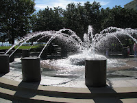
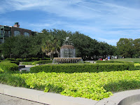 A stroll down East Bay Street brings one past lots of interesting buildings, most of which are either restaurants or boutiques of one type or another. Since I'm really not interested in those sorts of things, I continued down until I could go to the brilliantly named Waterfront Park. I like that as it describes both where and what it is. It's quite beautiful with a gravel path along the waterfront and a long tree lined promenade just a bit inland. There are two fountains both with signs indicating that there is no life guard on duty and that you shouldn't wade alone (along with the no spitting and so forth stuff).
 I walked down East Bay street to South Battery where there's another lovely park, this one with cannons salvaged from all over the harbor. One even has a plaque that more or less indicates the heroic efforts of saving the gun found on Sullivan's Island where the salvors had no idea why it had been there. Once again, the essential honesty of Charleston shows through. What you see here is what you get.

 Lower East Bay Street has some magnificent mansions. Most have regular tours. Each is different from the next and all are very well kept up. It's a very pretty street, I must say. The view over the harbor is spectacular, too.
 Finally, I made my way up Meeting Street where there are meeting houses, churches, cemeteries, museums, and homes. It's tree lined and pleasantly shady - even while it was almost 80 yesterday the street was cool. It encourages, like most of Charleston, relaxed strolling. All in all, I'd say Charleston is a town you'd like to slow down in.
Well, I'll be leaving Friday for Dataw Island to see friends and provision for a longer trip to Brunswick, GA.
See you on the water!
If you're at sea (and considering the Intracoastal Waterway that's a very loose interpretation), then it wasn't so much fun.
From Georgetown I went to a little creek, Graham Creek. It was the beginning of the crappy weather. I was in the company of John and Cheryl of Leprechaun - friends of Pat who runs the Pearson 424 web site. As I was a bit ahead of them I checked out what, in good weather, would be a lovely anchorage, Awendaw Creek. It's wide and deep and very open except where there's marsh. On a calm night, it would be spectacular - there are trees that block the light pollution from a couple of houses on the AICW.
But as the weather was deteriorating I thought it was too open for comfort. So we toodled on down to Graham Creek which is surrounded by marsh and has good holding ground and depth. The skies were gray and the wind was fairly steady at 17-25kts. Fortunately, no rain.
Since John's dinghy was rather well tied on, I decided to use my kayak to get over to their boat for cocktail hour (let's face it, that's the reason we travel, right? Cocktails in exotic places?) Anyway, after a couple of very pleasant hours I looked back to Pelican and notices my ladder had washed away! I've never had that happen! I had a few choice words as I returned later and flopped onto the deck in a most ungraceful way.
The next morning as our schedules meant waiting, we decided to hippity hop down the AICW about 10 miles to Whiteside Creek. Whiteside Creek is a really spectacular creek surrounded by marsh. It's wide open to the sky and very well protected from the seas. But the weather was deteriorating quickly.
So as we arrived Tuesday November 10 in the morning about 11:30, I got a chance to kayak around for a while. Then it started to rain. And blow. By the time I got on the boat, it just wasn't worth kayaking over to Leprechaun. In fact, I brought the kayak aboard to avoid it blowing away or banging on the hull all night.
Because of the tidal currents in the creek, the boat would change directions, sort of, every six hours - just enough to make new or different halyards bang. As Tuesday became Wednesday the weather got worse - now in addition to rain and wind it got cold - the daily high was about 50 and that, my friends, is really uncomfortable. So no kayaking that day, either. The same for Thursday.
By the end of Thursday I was ready to shoot myself in the head with my flare gun. I had planned to stay there until Saturday and get a slip in the Charleston Maritime Center for a couple of weeks, but I couldn't take it any more. When the wind dropped below 20 kts, I booked for Charleston, about three hours away.
Interestingly, the AICW exits into Charleston Harbor with a well marked channel. Well marked but not right - it didn't take long to go from 12 feet in depth to 3. When accessing the AICW, make sure you stand off the point and keep R 130 50 yards to starboard. Fortunately, it's all mud.
Anyway, now that I look at the paper chart I see the issue. It wasn't so clear on the chartplotter. That's a lesson for me, I guess.
There's a heck of a current that runs through the Charleston Maritime Center. Most people enter and leave on slack tide. Not me, though. Oh, no, I'm entering at max ebb with the wind gusting to 30 on the nose. Perfect. With a great deal of help from the dock guys I got tied up.
 The Maritime Center is a really nice marina - small, well tended, and the people are super nice. Those are some of the things that makes a marina worth visiting. They have free washer and dryer, reasonable electricity, weekly, biweekly and monthly rates, honor Boat U.S. cards and are literally three blocks from the old city. There is a big grocery store nearby (2.5 blocks) and in the main part of Charleston, a 15 minute walk, there are a bazillion restaurants.
I don't know if it's easier to get to marinas on the south side of the peninsula, but this one is worth the effort. It's also the least expensive of any of the marinas on Charleston proper. And it's the closest to the old town.
The downside, besides the current, is that it's a little rock-and-rolly. Wakes from everything come in here. I don't really care about that but there are some who do.
The historic portion of Charleston which essentially covers the whole of the peninsula is so history laden that I won't even go into it here. Read about it. Pretty much if anything was happening here in the United States or the Colonies, Charleston had something to do with it. From the Revolution to the unpleasantness between the North and South, Charleston was smack dab in the middle of the fray.
 In what I consider a great irony, there is on Market Street, several blocks of market booths, called City Market, where you can purchase any manner of jewelry, knick-knacks, geegaws, t-shirts and what-nots housed in long buildings of brick with trestle beamed roofs. The irony is that this set of buildings were, in former times, slave markets. Many of the people hawking aforementioned merchandise no doubt are descendants of those very same slaves.
 Just down the street is one of the most impressive buildings in Charleston - the U.S. Customs House. I'm not sure what goes on there but you have to admit, this is one massive building. On the north side of Charleston are at least two major ports - one, apparently, for the export of BMWs (including Minis) that are built here in South Carolina. Just north of that past the marina is another container port. There's lots of big ship traffic here.
 A stroll down East Bay Street brings one past lots of interesting buildings, most of which are either restaurants or boutiques of one type or another. Since I'm really not interested in those sorts of things, I continued down until I could go to the brilliantly named Waterfront Park. I like that as it describes both where and what it is. It's quite beautiful with a gravel path along the waterfront and a long tree lined promenade just a bit inland. There are two fountains both with signs indicating that there is no life guard on duty and that you shouldn't wade alone (along with the no spitting and so forth stuff).
 I walked down East Bay street to South Battery where there's another lovely park, this one with cannons salvaged from all over the harbor. One even has a plaque that more or less indicates the heroic efforts of saving the gun found on Sullivan's Island where the salvors had no idea why it had been there. Once again, the essential honesty of Charleston shows through. What you see here is what you get.
 Lower East Bay Street has some magnificent mansions. Most have regular tours. Each is different from the next and all are very well kept up. It's a very pretty street, I must say. The view over the harbor is spectacular, too.
  Finally, I made my way up Meeting Street where there are meeting houses, churches, cemeteries, museums, and homes. It's tree lined and pleasantly shady - even while it was almost 80 yesterday the street was cool. It encourages, like most of Charleston, relaxed strolling. All in all, I'd say Charleston is a town you'd like to slow down in.
Well, I'll be leaving Friday for Dataw Island to see friends and provision for a longer trip to Brunswick, GA.
See you on the water!
Sunday, November 08, 2009
Georgetown, South Carolina
 I love night sailing. The whole sky puts on a show and I could stare at the stars forever! With that in mind, I left Bald Head Island Marina about 5pm November 7, 2009. The idea was to get out to the Cape Fear safe water buoy before dark. The winds were light but enough to sail with and the current was with me so even with not much sailing speed I was still going 6 plus knots over the ground.
I thought this would be a good time to try the Monitor Windvane and so I did. Son of a gun, it really works - it's a pain when the wind is shifty or very light, but it works and it saves all sorts of power when sailing. I got a pattern for a paddle from Scanmar (the people who make the thing) for a ketch rig so the mizzen boom doesn't smash it, but I think I should have used the light air paddle - the one I made was just too touchy. In light air of less than 6 knots apparent it just doesn't keep a course very well. There's no surprise there because the manual mentions that.
But for longer passages with good wind (10+knots) this baby will save all sorts of power and will steer a darn good course! I'm impressed and quite thrilled.
I'd've taken a picture but it was pitch black by the time I got it all sorted out. Maybe one day I'll do it again and take said picture.
Most of the night was motor sailing. I was running just above an idle - not really good for a diesel but very easy on the fuel. Also, I didn't want to get to Winyah Bay Inlet before daylight so I had to keep to about 5 knots over the ground.
 Every so often the wind would increase and we'd be moving right along so I could stop the engine and test the shaft generator. It works, but not below about 4.5knots. Then it uses power rather than generates it. The upside is that at a solid 5 knots it will supply enough power for the autopilot, all the instruments, and the refrigerator. I suspect that at 6 knots, it'll power the water maker, too. But with 10 knots of wind I couldn't test that.
The downside is that it's noisy. I'm not sure if it's the rotating gear or the stress on the v-drive, but I'm going to have to find that out. It could just be that the split pulley isn't balanced all that well. But as an experiment, I'll call it a success!
 I arrived at the channel entrance exactly at 7:00am and started up the bay for Georgetown. True, it's like 6 miles out of my way going down the AICW, but I heard it was nice here and I needed fuel anyway. So I stopped at Boat Shed Marina for the evening, putting the boat away and taking on fuel and water. I decided to have a bit of a walk in town and maybe grab some lunch.
Ok, Georgetown is guarded from boaters approaching from the south by the stench from the paper plant. Apparently, the two big employers here are International Paper and a steel mill. The paper plant emits a foul odor that travels at least 10 miles over Winyah Bay. But once past the foul plume, Georgetown is a very pretty town. The waterfront contains a mixture of working and pleasure vessels with a large proportion developed with a boardwalk. It's lovely to walk there.
 The main street, Front Street, has a theater and several restaurants and touristy stores as well as a large department store. It is truly like Main Street USA - the kind of boulevard that we pine for now. It is nostalgia made real. It's maybe three New York avenue blocks long. Because it's Sunday most of the shops are closed - but a few of the restaurants are open. Now, I'll do fru-fru eating every so often (less often now while I have no job), and with that in mind, I was looking for a good place to eat.
 Way at the far end of town is Aunney's (pronounced onnies , like Donnie's without the 'D'). If you like country food and plenty of it go there. On Sunday they have a limited menu, but not that limited - I had fried chicken, collard greens, mac & cheese, a piece of cornbread, rice, and iced tea for $11.00 - and it was only that because I had all white meat ($1.00 extra - I was feeling expansive). All the women there are super nice and if you like good down-home cooking and good conversation this is the place.
 Kindle (yes, like the reading device) was mostly my server. But no matter who ends up serving you, you'll enjoy it and have a darn good meal. You won't leave hungry. I only wish I could have had some of their home-made desert! Mmmmm. Highly recommended! Super friendly!
 The east end of Front Street is tree lined and the trees are gorgeous! This is what tree lined streets should look like!
If you're traveling by Georgetown on your way through the ICW, you should stop and set a spell.
See you on the water where I'll meet some new friends tomorrow at an anchorage!
Friday, November 06, 2009
Two Truly Cool Places
'Sailing' down the Atlantic Intracoastal Waterway (AICW) is a dull as dull can be. True, there's some spectacular scenery, but when you get right down to it, it's a slog. Get up, get going, decide on an anchorage or marina, stop, go to bed. Repeat as necessary until you get somewhere interesting.
Having said that, I've looked to stop in marinas that are sort of off the beaten path with good rates or good scenery or both.
 When I was getting to Wrightsville, NC for a meeting (also a catching up with friends, doing laundry and looking for an oil pressure gauge), I decided that rather than wait an hour for the Surf City swing bridge, I'd stop at the Beach House Marina. The dockmaster is Earl and the place is clean, very friendly, and at $1.25/ft including electricity a true bargain. Highly recommended.

 Surf City, NC is quite a place, too - there's a really nice park that straddles the east coast of the AICW and has long wooden walks suspended over swamps - very pretty. They are clearly new-ish.
Contained in Surf City within easy walking from the marina is everything you could want including an IGA, a slew of restaurants (Daddy Mac's is pretty good - and eating on the deck overlooking the Atlantic is pretty special). There's a little breakfast nook, too, that is dirt cheap - a full breakfast 2 eggs, toast, home fries, coffee and bacon is like $4.99. Can you beat that? I submit not.
The downside to these places is that smoking is allowed in them. Yech!
Ok, so after spending the next day with friends and business discussions and eating and laundry, I got Pelican ready to leave for the 8 am Surf City Bridge opening and promptly ran aground. Fortunately, it was only for a minute. As someone once said, there are two types of sailors on the AICW - those who run aground and those who lie.

 So, after a stultifying day, I'm at Bald Head Island Marina. This is a little hole in Bald Head Island across from Wilmington, NC and at the entrance to the Cape Fear inlet. This is a cute little marina on a very exclusive island. There are no cars, just golf carts. It's well manicured. There's a restaurant (Eb & Flo's) that in the season provides conch fritters that I'm told are better than you can get in the Bahamas. Sadly, the season is over and so I can't get any. Feh. Also, if there's a slip that's the farthest from the bright center of activity here on the island, I'm in it.
The winter montly rates here, including electricity, are very reasonable! Hmmm, well, I'm just sayin' here.
Why am I here? Because tomorrow at 5-ish or so I'm leaving for an overnight sail to Winyah inlet for Georgetown, NC. I may spend a couple of days there before going to Charleston. But the point is to have an overnight sail straight away and arrive in daylight.
The weather is supposed to be very nice, if cold. Tonight it's supposed to get to 38 degrees! Eww - I left Connecticut to get out of that crap! Still, Saturday night is supposed to be awesomely clear so I'll be on either autopilot or Monitor Windvane laying on the deck watching the incredible stars! But I'll also be watching.
I hope also to be able, finally, to test the shaft generator. I'm hoping there's enough wind to sail but not so much I'm terrified. I guess that's pretty much what all sailors want...
See you on the water! If I don't, though, steer clear - I'm stargazing!
Having said that, I've looked to stop in marinas that are sort of off the beaten path with good rates or good scenery or both.
 When I was getting to Wrightsville, NC for a meeting (also a catching up with friends, doing laundry and looking for an oil pressure gauge), I decided that rather than wait an hour for the Surf City swing bridge, I'd stop at the Beach House Marina. The dockmaster is Earl and the place is clean, very friendly, and at $1.25/ft including electricity a true bargain. Highly recommended.
 Surf City, NC is quite a place, too - there's a really nice park that straddles the east coast of the AICW and has long wooden walks suspended over swamps - very pretty. They are clearly new-ish.
Contained in Surf City within easy walking from the marina is everything you could want including an IGA, a slew of restaurants (Daddy Mac's is pretty good - and eating on the deck overlooking the Atlantic is pretty special). There's a little breakfast nook, too, that is dirt cheap - a full breakfast 2 eggs, toast, home fries, coffee and bacon is like $4.99. Can you beat that? I submit not.
The downside to these places is that smoking is allowed in them. Yech!
Ok, so after spending the next day with friends and business discussions and eating and laundry, I got Pelican ready to leave for the 8 am Surf City Bridge opening and promptly ran aground. Fortunately, it was only for a minute. As someone once said, there are two types of sailors on the AICW - those who run aground and those who lie.

 So, after a stultifying day, I'm at Bald Head Island Marina. This is a little hole in Bald Head Island across from Wilmington, NC and at the entrance to the Cape Fear inlet. This is a cute little marina on a very exclusive island. There are no cars, just golf carts. It's well manicured. There's a restaurant (Eb & Flo's) that in the season provides conch fritters that I'm told are better than you can get in the Bahamas. Sadly, the season is over and so I can't get any. Feh. Also, if there's a slip that's the farthest from the bright center of activity here on the island, I'm in it.
The winter montly rates here, including electricity, are very reasonable! Hmmm, well, I'm just sayin' here.
Why am I here? Because tomorrow at 5-ish or so I'm leaving for an overnight sail to Winyah inlet for Georgetown, NC. I may spend a couple of days there before going to Charleston. But the point is to have an overnight sail straight away and arrive in daylight.
The weather is supposed to be very nice, if cold. Tonight it's supposed to get to 38 degrees! Eww - I left Connecticut to get out of that crap! Still, Saturday night is supposed to be awesomely clear so I'll be on either autopilot or Monitor Windvane laying on the deck watching the incredible stars! But I'll also be watching.
I hope also to be able, finally, to test the shaft generator. I'm hoping there's enough wind to sail but not so much I'm terrified. I guess that's pretty much what all sailors want...
See you on the water! If I don't, though, steer clear - I'm stargazing!
Saturday, October 31, 2009
Engineering a Solution
 I'm sure my windlass has not been serviced since I purchased Pelican and given human nature, probably not since it was installed. One of the major service items is to change the oil in the gear case. But it takes two men and a boy to get the darn thing out - and that's what's required to change the oil.
The measure of oil is that it is halfway up the sight glass. Since I couldn't even see the level either because it was too low or because the glass was scuzzed up, I wanted to refresh it but without dropping the motor and gear housing. Both tasks are onerous.
 So I had a brilliant idea - namely, drill and tap a hole right in the middle of the sight glass. To drain the oil, remove the sight glass and let drain. I used a syringe to make sure all the oil was out. Then I put the sight glass back in, filled through the newly drilled and tapped hole in the center until the level was just higher than the hole with the syringe and finally, put the bolt back in the hole before it all leaks out - but even if it does leak out, it will leak to just a tiny bit below the optimum level.
 The bolt is wrapped with teflon tape that keeps it from leaking, binding, and rotating out by itself. It is only finger tight so there's no strain on the plastic sight glass.
Now all that remains to be seen is what happens when I run the unit with the anchor on it. I expect nothing special besides the anchor going up and down.
You would think that Maxwell would have put a drain and fill plug on the gear case. There is room and it would make maintenance far more palatable.
See you on the water!
Friday, October 30, 2009
Beaufort, North Carolina

 Beaufort. BO-Fort. I am not much into shopping boutique stores. I like architecture but I really detest cute. So first, here are some pictures of Beaufort from the boat - this is the town's main waterfront area. The left picture is the Maritime Museum and the right is the Beaufort Town Docks - a very nice place to dock and the people are pretty nice, too. But that's not what I'm on about here today.
You all have seen an historic town. Beaufort looks just like that. To its credit, it has a really good and really cheap diner like place that you can get stuffed for breakfast for around $7.00 and that includes coffee and a tip. They also have a very good and very expensive restaurant called "The Grocery" where if you're hungry and feeling flush, it's a good place to go. Then, there's the Back Street Bar. More on that later in this journey, perhaps as early as tomorrow.
 This being near Halloween I thought what I'd talk about is one of the best graveyards I've ever seen. Sure, we have pretty good ones there, but on this side of the Atlantic, if you're thinking scary thoughts about a scary cemetery you are very likely thinking of this one or one so similar that it doesn't matter.
 The last time I saw a cemetery anywhere like this was in England. I have to say, though, that I'd be pretty apprehensive to be here on any given moonless night.
This graveyard also contains an area where the casualties of an Indian war in 1722 happened - there are no markers left, but there is a little sign.

 I find the graves to be really interesting, if only for their construction. There are a few WWII graves but most of them date to the 1860's and earlier. I'll leave you to contemplate the pictures at least for tomorrow night. You can bet I won't be there.
Well, someone I've wanted to meet since I got involved with the Pearson 424 organization is one Tor Pinney - to say he's sailed a great deal would be vast understatement. He's written a book about preparing a boat for offshore work and he regularly submits (and gets published) articles in Cruising World and other magazines.
Well, as I was putting Pelican to bed upon arriving here a man motored up in his dinghy and it was none other than Tor - we've been having discussions on the board for at least two years. As some of the other members were to meet at the Annapolis Boat Show, he indicated "none of look like we expect." He, of course, is right - we make pictures of strangers in our mind and are almost always surprised at what we see when we meet. I must say, my picture was of a great man with a beard and flaming red hair. I suspect I've read too many comics.
But that he doesn't match that image is not important - he's a terrific guy, knowledgable and experienced, and more than that, willing to share his knowledge. One of the good people in the world, I have to say.
Anyway, he's playing in town Saturday night so I'll pop over for that.
I had a bit of a scare with the dinghy - yesterday in town I came back and two of the chambers were partially deflated. I thought maybe someone was messing with me. I limped back to the boat and pumped them up and they stayed inflated all night. But in the morning I popped over to Tor's boat (Silver Heels) and as I was going one tube kept deflating. "Crap!", I thought to myself, "I have to fix that!"
Once again I limped back to the boat and hauled the engine off, attached the spinnaker halyard to the lifting harness and heaved the whole thing on deck. Using soapy water I sprayed everywhere - I couldn't find a leak -except as Tor pointed out, probably one of the fill valves. Well, there you have it, tightened the fill valve fitting and put the whole thing back in the water and away I went.
Before I left from Stamford, I purchased a Citizen folding bike (the Gotham model with fenders). It is the least expensive folding bike I've seen and it fits under the table, weighs like 20lbs, and rides pretty nicely. It's an all aluminum frame with standard parts. I took it out for a spin today, mostly to see how it does in the dinghy and the issues with loading and unloading it. (There are none).
That's my story and I'm sticking to it. Right now it's almost cocktail hour and I thought I'd pop over to town for a bit of a happy hour.
See ya on the water!
Tuesday, October 27, 2009
An evening at Broad Creek
I know I'm like two days behind. Yesterday was one very long day and today much shorter with a sweet landing.
I left from Coinjock yesterday about 7:30am. There were people to help on the dock so the job was easy. It turns out that you need your up-current end shoved of into the current and nature does the rest. The current through Coinjock must have been running the day before when I arrived somewhere near 4 knots! By the time I turned around to land I was a half mile down the canal!
But I digress - also, since I had dinner at Crabbies I can tell you this: the crab chowder is marvelous. The stuffed flounder was way over cooked. There wasn't enough tartar sauce in the restaurant to cover that baby.
I digressed again, didn't I?
Well just a short while east the canal opened up into the North River which leads to the Currituck Sound out to the Albemarle. Some friends I had met, Tom and Charlene on their Krogen 39 (Forever 39) were overtaking me as I was attaching the staysail halyard - and trying to look all salty, I walked to the mast and gave the halyard a great heave only to have it become unshackled and sail up to the spreaders.
Nonchalantly, I walked back to the cockpit and unfurled the jib. Needless to say there was a good deal of swearing going on - I managed to get the sail under control and off we went at about 7 knots! Woohoo! Shut the engine and sailed! Can you believe it?
Raised the mizzen and all went spectacularly. Pelican was in her glory, I'll tell you - she motors pretty ok, I guess, but when the wind's 20 kts or so, man she GOES!
I was told that the two sounds would be horrendous. I don't know where these people go, but at 2-3 feet, they were totally manageable and not at all rough, really. I mean Pelican handled them with aplomb.
We ended up motor sailing down the Albemarle because I had to make it to the end of the Pungo Canal before dark. Well, not really, but I wanted to. To say that the Pungo Canal is dull would be to be wildly exaggerating. It would be hyperbole. The charts say it's got a cypress swamp on one side. Sadly, the swamp is dying. Boats leaving large wakes wash the soil from the roots with the result that the trees eventually topple. The northern edge is already dead from something or other and the trees nearest the canal are dying. Come see it now before it's gone. Don't leave a big wake.
Anyway, I ended up at the end of the Pungo River Canal in a terrific anchorage just to the right of the last buoy. For those of you following me, you know were I was. The night was cold, drizzly, and damp with a pretty strong wind from the north. All snuggled up in my bed with lots of pillows I slept the sleep of, well, the sleepy. It was marvelous.
This morning, however, turned out to be a bit less sanguine (incidentally, I love the word 'sanguine' - it's from the French word for 'blood' (to parenthesize parenthesis - so is 'exsanguination' another terrific word but hardly useful for this blog) ) . As I left the anchorage, the fanbelt that runs the alternator and the fresh water pump on the engine broke. After much hopping about swearing, I had to anchor again and rip the boat apart to change the belt. This took about an hour.
Well, then I was off again! Today I made it to River Dunes, in Broad Creek on the Neuse River. It sounds like a gambling casino but it's not. It's a lovely water community in a place that you'd never expect. Broad Creek is a little, shallow creek with a pretty good anchorage. When you motor up it there's a little channel off to the port that you would think goes to someone's home. But a little way in, it turns into a masonry lined channel that opens up into a large basin with a marina inside! You could not be more surprised than if you walked into a dumpy looking restaurant door and inside was this huge gourmet dining establishment! (Incidentally, I had another surprising thing to compare this to but it is a family blog after all.)
It's a most modern facility and I got to stay on a 'T' dock for $1.25/foot for the night! Can you believe that? That's like when I started sailing! It's almost cheaper with electricity ($5.00) than the friggin' moorings at Sagamor Yacht Club. I mean, really!
So that's today's adventures. More when I get to Beaufort, NC where I pick up a mooring I've rented for a month for next to nothing.
Frankly, this cruising life has started out totally ok!
See you all on the water!
Saturday, October 24, 2009
Resting at Great Bridge VA
 Well, we made it to Great Bridge, VA Friday afternoon around 1:30ish. We were very happy to get into the Atlantic Yacht Basin that Cory has been to many times, and recently I have with him. It's a few hundred yards east of the Great Bridge Bascule Bridge on the south shore of the ICW. Because it's in a fresh water section of the ICW, there's no tide to speak of unless there's a strong wind out of the east that piles up water here.
This place is a full service yard - they have any number of large and small boats in various stages of repair at any one time. Lest that give you the impression they work willy-nilly let me disabuse you of that notion. Every work site is clean and well maintained. The yard people wear their safety gear and seem, to me anyway, to work a good day's work. I'm impressed.
Their marine store isn't like any other. Because of the work they do, it's well stocked with things you need and need badly. There's no frippery there, I'll tell you what.
The dock masters are knowledgeable and really helpful.
As you know if you've been following my SPOT information, we started out around 9:30am Wednesday from Great Kills Yacht Club. There appeared to be wind filling in from a direction we could sail in - we were headed out to the Sandy Hook Channel. The breeze was light and as it turns out we couldn't sail. We didn't find that out until all the sails were raised, though.
So, essentially, you leave the Sandy Hook Channel when you can clear the shoals and make a right any stay on that course until you hit (figuratively) Cape Charles at the entrance to the Chesapeake.
Because the weather for Thursday was going to be 20kts out of the southwest (in other words, right on the nose) we decided to run a little closer to the coast. In any case, we were making good time until Thursday around noonish when the wind settled in right on the nose (as predicted). We were 20 miles out with seas building to an uncomfortable 2 - 6 foot chop and pounding into it. Pelican does not like to motor into that. Neither does her owner.
We worked our way west with the staysail and mizzen until we were in around 35 feet of water just south of the Delaware River. From there you can almost make a beeline to Cape Charles.
The engine was behaving beautifully until we were about an hour from Cape Charles at about three in the morning. Then it stopped. Plenty of fuel. Pump working, but air in the Racor. Long story short, the original rubber fuel line had a gotten a split in it and we were able to get a good connection to the fuel pump and get the engine running again after about an hour and a half.
As we rounded Cape Charles the wind died (because we could have sailed into the Chesapeake otherwise) and we got to Norfolk about 7:30am. We went through the assorted bridges until we got nearly to Great Bridge. There the Dominion Boulevard Bridge (aka 'Steel Bridge') only opens on the hour. Of course we were an half hour early (we had just missed the opening). So we tied up to a dock nearby to wait.
 After the Steel Bridge, there is the Great Bridge Lock which opens when? On the hour on the half hour. Fortunately they were opening the gates as we came up and we got in right away. Actually, we were looking to tie up to wait and wanted to see what the signs said at the entrance so motored up there. That's when we noticed it was opening. If you were in a boat in that lock opening - really, we're sorry.
 Ok, well, the lock takes a half hour to cycle and then there's the Great Bridge Bascule bridge which opens when? On the hour. If you're really, really lucky you can catch them all and make it through in an hour. If you're not, it's two hours. We weren't.
So Friday at the Atlantic Yacht Basin we really didn't do anything - had some wine and cheese and went fairly early to the Mexican restaurant across the road - El Toro Loco. It was awful. Not at all recommended. We forced ourselves to stay up until 8:00pm. Woohoo! what a wild bunch we are!
This morning, Saturday, we all got up early, had a cup of coffee and Cory and Jim were on their way home via taxi and train (Amtrak from Newport News). I did laundry, changed the oil in the engine, and replaced the faulty fuel hose which I had purchased Friday afternoon in the hopes of dealing with it then.
After that, I moved across the canal to a free dock and am here now.
On the dock with me is a DeFever 53 owned by Karen and Jeffrey Siegel who happen to own and run a site ActiveCaptain, an interactive cruising guidebook. This is a great site, too, that is constantly being updated by cruisers! It's free but you have to register. I just started looking at it and I can totally see its utility. I think I'll be on that site pretty often!
It's such a good site, you'll see it on my sidebar.
Tomorrow morning, I'm off to Coinjock to have a 32oz. steak. No, not really, but to gather myself together to go down the Albemarle Sound. Hopefully the bridge will open on the Alligator River when I need it to...
So there you have it! The first exciting days of what promises to be an exciting trip!
See you on the 'ditch'!
Tuesday, October 20, 2009
Day One - Great Kills, Staten Island, NY

 Here I am at the Great Kills Yacht Club in a small harbor on the southeast corner of Staten Island - I left Stamford CT this morning at 7:45 and had current with me all day except for about a 20 minute period through Hell Gate.
It was a beautiful day! Partly cloudy and in the high 40's. It could only have been better if the wind wasn't on the nose all day! But that's sailing in Long Island Sound and New York Harbor!
Still, a very pleasant day all in all. New York Harbor was busy as usual. Of course I had to take a picture of 'The Lady'.
 Also, I'm testing my video - clearly I need to work on that bit - a short one is 185Mb and that's too much. Maybe I'll figure it out by Norfolk!
Tomorrow will be our trip offshore - Cory and Jim will be with me. We should arrive at Norfolk on Friday morning and make it to Coinjock.
 While I was here, I met the owners of Roving Seas, an Island Gypsy 44 that I passed in the East River between the Throgs Neck and Whitestone Bridges. They had hailed me earlier and we'd discussed our plans so I knew they'd be in Great Kills. It's so seldom anyone gets a picture of their boat underway, I thought I'd take a couple and email it to them.
Brian and Jan could not be nicer. We had a bit of discussion and wine on Roving Seas before they had to head off to meet their son for dinner. They also turned me on to a great site, Cruiser's Net. It's all about cruisers helping each other out. While I was waiting for Cory and Jim the next morning I helped them off the dock.
Their goal is Marsh Harbor, Bahamas, too, so I hope to see them there!
See you on the ocean!
Subscribe to:
Posts (Atom)